 |
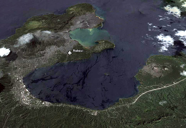
This is a photograph of Rabaul after the earthquake in 1997. The grey parts to the top left are areas covered in volcanic ash with the 'aeroplane' shape being where the old airstrip used to be. The house that we used to live in is under the area covered by the ash. The volcano to the top of the photograph is still very active and is the one I climbed to the top.
|
.JPG) |
| Simpson Harbour from the Observatory |
.JPG) |
| The volcanoes from Kokopo |
.JPG) |
| Inside the Tavurvur Volcano |
.JPG) |
| Inside the Tavurvur Volcano |
.JPG) |
| From the top of the volcano towards Rabaul |
.JPG) |
| From the top of the volcano showing the old airstrip |
.JPG) |
| Hot springs at the sea edge |
.JPG) |
| Hot springs at the sea edge |
.JPG) |
| Rabaul Cathedral |
.JPG) |
| Inside Rabaul Cathedral where fresh flowers are put on the alter still even though the cathedral is no longer used |
.JPG) |
| The remains of the Electricity Commission office where I once worked |
.JPG) |
| What was left of the main street of Rabaul |
.JPG) |
| Where the old market used to be. The market was said to be the best in the Pacific area. |
.JPG) |
| School children getting a lift home |
.JPG) |
| Rabaul from the top of the volcano |
No comments:
Post a Comment